Spatial Search
Open data platform with semantic search and real time GIS analysis
- toolSpatial Search
- year 2014
- functionalitysemantic search, real time GIS queries, raster and vector visualization, user registration and download of SHP, DXF and PDF
- development phasebeta
- licencefree
- linksearch.oscity.nl
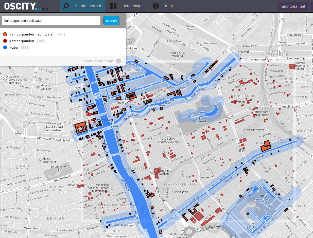
OSCity Search is an open spatial data platform that allows quick access to most of the OSCity database which contains most public datasets available for the Netherlands and much more. By simply typing in keywords the user can visualize, explore and export information on topology, real estate, demographics, amenities, networks and much more.
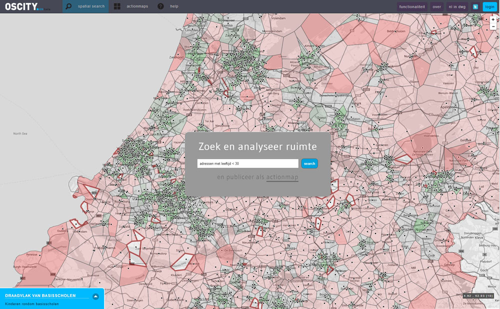
It is also equiped with semantic search capabilities that are able to transform natural language into GIS queries. Examples offices near water, supermarket with name Aldi, addresses with age < 30
The platform is an invitation to explore the possibities of open data to help advance spatial planning. Thanks to the Creative Industries Fund NL and The New Institute this platform is entirely free to use. By registering extra features are available like export to Shapefile, Autocad DXF and PDF.
Since 2022, OSCity Search is no longer publicly available. We do create advanced custom search engines. Contact us for the possibilities or a demo!